Northern life and Inuit culture
Salluit
Location
The northern Inuit village of Salluit is located on the Hudson Strait, on the east bank of the Saglouc Fjord, 120 kilometers east of Ivujivik and 600 kilometers northwest of Kuujjuaq. The territory of Salluit, designated as Category 1 land, is comprised of 625.7km2. The surface area of the territory and the rights attached to it are defined by the James Bay and Northern Quebec Agreement. Principle access to Salluit is by air.
Presentation
Seasonal camping grounds for the Inuit since the beginning of time, the region of Salluit developed an important role in the 20th century fur trade. Two trading posts, one independent and the other with the Hudson’s Bay Company, operated side by side throughout most of the century. The Purtuniq mine, fifty kilometers from Salluit, at Deception Bay, is a significant player in the local economy. “Saglouc” and “Sugluk”, names by which the community has been known in the past, are variations of Salluit, the Inuit word for “skinny people”. The name was officially adopted when the village was incorporated in 1979.
Administration
Local administration is assured by the municipal council of Salluit as established by the Northern Village Corporation. The Northern Village of Salluit council is part of the Kativik Regional Authority.
Economy
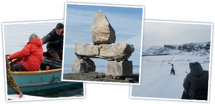
Seal, beluga whale and walrus hunting are traditional activities which remain important in the community, although they have lost ground since the arrival of the Purtuniq mine at Deception Bay. New Quebec Raglan Mines layer is presently in operation near to Salluit by the Falconbridge Cie of Rouyn-Noranda what contributes to the economy of the village.
The local cooperative store is active in retail sales, arts and crafts production, and the commercial fur trade.
Services
There is a dispensary with nursing staff in the community, along with day-care facilities, a community center and the Qavvik Hotel.
Salluit has a community radio station : Radio Salluit, 89.9 MHz.
For more info: www.nvsalluit.ca
